Breaking: Colwash Fire Prompts Mass Evacuations in Washington
Colwash Fire Intensifies, Triggers Urgent Evacuations in Washington State
By Decode Today News
In a rapidly evolving situation, the Colwash Fire, originating approximately two miles northeast of BIA Road 15 and 196 near Toppenish, Washington, has escalated dramatically, now consuming an estimated 4,000 acres. The fast-moving blaze has triggered Level 3 "GO NOW!" evacuations across significant portions of Yakima and Benton Counties, posing an immediate threat to both life and property, according to official reports from the National Interagency Fire Center and local emergency services.
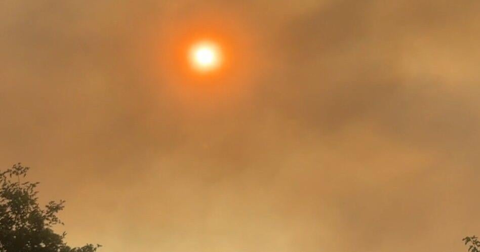
The fire, which was initially reported around 8:40 a.m. on Saturday morning as a vegetation fire spanning an estimated 25-30 acres, has seen an exponential increase in size. An earlier official update placed its acreage at 700 before the latest report confirmed the 4,000-acre mark, underscoring the formidable challenge faced by first responders and emergency management teams.
Immediate Threat: Level 3 "GO NOW!" Evacuations Underway
Authorities have issued critical Level 3 evacuations, signaling an immediate danger to residents and structures. This directive means residents must leave now, as there is an immediate threat to life and property. These urgent calls for evacuation are being coordinated by local law enforcement and emergency management agencies.
Specific areas under the Level 3 "GO NOW!" order include:
- West-Central Benton County, South of Prosser: This encompasses regions east of the Yakima/Benton county line, south of WA-22, south and west of WA-221, and north of Sellards Road. These alerts are issued due to the fire’s rapid progression into Benton County, as reported by dispatch traffic.
- Yakima County – WA-22 Corridor: The area along WA-22 from Glade Road to the county line, including Byron Hill Road, is also under a Level 3 "GO NOW!" evacuation. This information was confirmed by Yakima Valley Emergency Management, which emphasized the immediate danger to life and property in these zones.
Preparatory Action: Level 2 "BE SET" Evacuations
In addition to the immediate evacuation orders, Level 2 "BE SET" evacuations have been enacted for western Benton County, south of Prosser. This covers areas east of the County Line, south of WA-22, south and west of WA-221, and north of Sellards Road. Residents in these zones are advised to be packed and ready to leave at a moment’s notice, per Benton County Emergency Services. The Level 2 status highlights the unpredictable nature of wildfires and the need for proactive preparedness to ensure community resilience and minimize potential losses.
Logistical Challenges: Road Closures and Emergency Shelters
The fire’s expansion has necessitated significant logistical adjustments to facilitate evacuations and ensure the safety of emergency personnel. The Prosser Police Department has explicitly requested that the public stay off WA-22 between Market Street and Byron Street. This closure is critical for allowing residents to evacuate safely and for first responders to execute their duties without obstruction, illustrating the severe operational disruption caused by such events.
Furthermore, law enforcement has requested the shutdown of Sellards Road from Bert James Road to the county line, according to dispatch traffic. These road closures are vital for maintaining clear access for firefighting apparatus and ensuring the orderly flow of evacuating traffic, mitigating further cybersecurity risk from potential traffic jams or unexpected hazards.
For those displaced by the evacuations, a Red Cross Shelter has been established at Prosser High School, located at 1500 Paterson Road, Prosser, WA 99350. This provides a crucial point of relief and support for individuals and families impacted by the unfolding disaster, showcasing the immediate community support infrastructure.
Understanding the Dynamics of Rapid-Onset Emergencies
The Colwash Fire serves as a stark illustration of the challenges inherent in managing rapid-onset emergencies. The "breaking" nature of such news often involves a dynamic situation where information, like the fire’s acreage, can evolve quickly. Emergency management systems, such as those employed by the Yakima Valley Emergency Management and Benton County Emergency Services, are designed to respond to these fluid circumstances, using a multi-tiered evacuation protocol to protect populations.
The distinction between Level 3 "GO NOW!" and Level 2 "BE SET" evacuations is a cornerstone of emergency preparedness, reflecting varying degrees of immediate threat. Level 3 signifies an undeniable, immediate danger, requiring swift action to preserve life and property. This often involves significant resource allocation from multiple agencies, including local police, fire departments, and state and federal forestry services. The operational margin for error in these critical moments is extremely thin, necessitating clear, concise communication and well-rehearsed protocols to maintain order and maximize safety.
The rapid growth from an initial estimate of 25-30 acres to a staggering 4,000 acres underscores the volatility of vegetation fires, particularly in conditions conducive to rapid spread. This demands constant monitoring and agile decision-making from entities like the National Interagency Fire Center, which provides vital intelligence on fire behavior and resource needs. The overall enterprise integration of these disparate agencies is crucial for an effective and coordinated response.
Key Developments and Ongoing Situation
Below is a summary of the critical developments concerning the Colwash Fire:
| Detail | Description |
|---|---|
| Fire Origin | Approximately 2 miles NE of BIA Rd 15 & 196, Toppenish, WA |
| Current Acreage | 4,000 acres (per National Interagency Fire Center) |
| Evacuation Level 3 | West-central Benton County (south of Prosser), Yakima County (WA-22 from Glade Rd to county line, incl. Byron Hill Rd). Immediate threat to life and property. |
| Evacuation Level 2 | Western Benton County (south of Prosser). Be packed and ready to leave ASAP. |
| Road Closures | WA-22 between Market St and Byron St (Prosser), Sellards Road from Bert James Road to county line. |
| Shelter Location | Red Cross Shelter at Prosser High School (1500 Paterson Road, Prosser, WA 99350) |
| Primary Source | National Interagency Fire Center, Yakima Valley Emergency Management, Benton County Emergency Services, Prosser Police Department, dispatch traffic. |
While an official map from Yakima Valley Emergency Management is still pending, local news outlets, including Apple Valley News Now, are actively working to gather and disseminate the latest information. The situation remains highly dynamic, with authorities continuing to monitor the fire's trajectory and adjust response efforts accordingly to safeguard public safety and mitigate further damage. The focus remains squarely on the efficient management of this crisis and ensuring the well-being of all affected residents.


